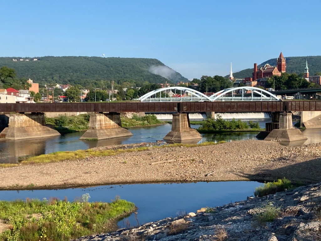
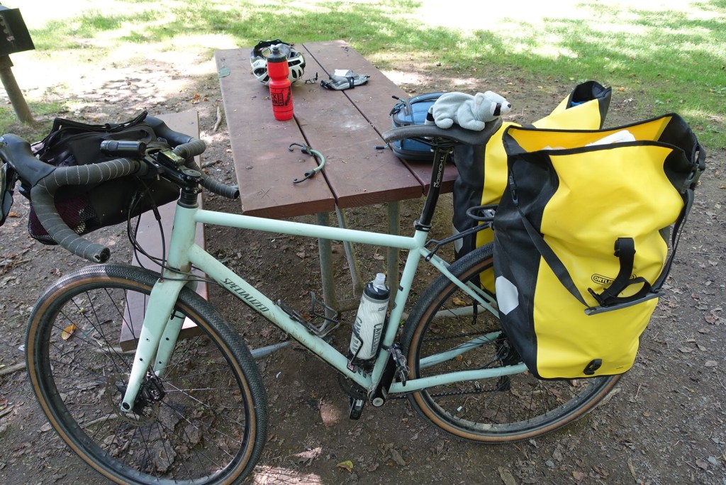
I had a crisp and clear morning of riding today, leaving Cumberland for Little Orleans, a distance of 45 miles. As I began, I got my first sight of the north branch of the Potomac and the C&O Canal, and started riding the canal’s towpath east. This part of the trip is 185 miles and will take me four days.
The towpath is very different from the Great Allegheny Passage, which is an old railroad bed and has been resurfaced with crushed limestone, an excellent surface for cycling. The C&O, in contrast, was made for mules to tow boats. Its surface is hard-packed dirt—mud in places—with some gravel, tree roots, hard rock and the occasional tree limb. I found it wasn’t too muddy today, but the constant jarring of the gravel and the bumps of the occasional unexpected tree root gets fatiguing, even with my bike’s fat (42mm) tires.
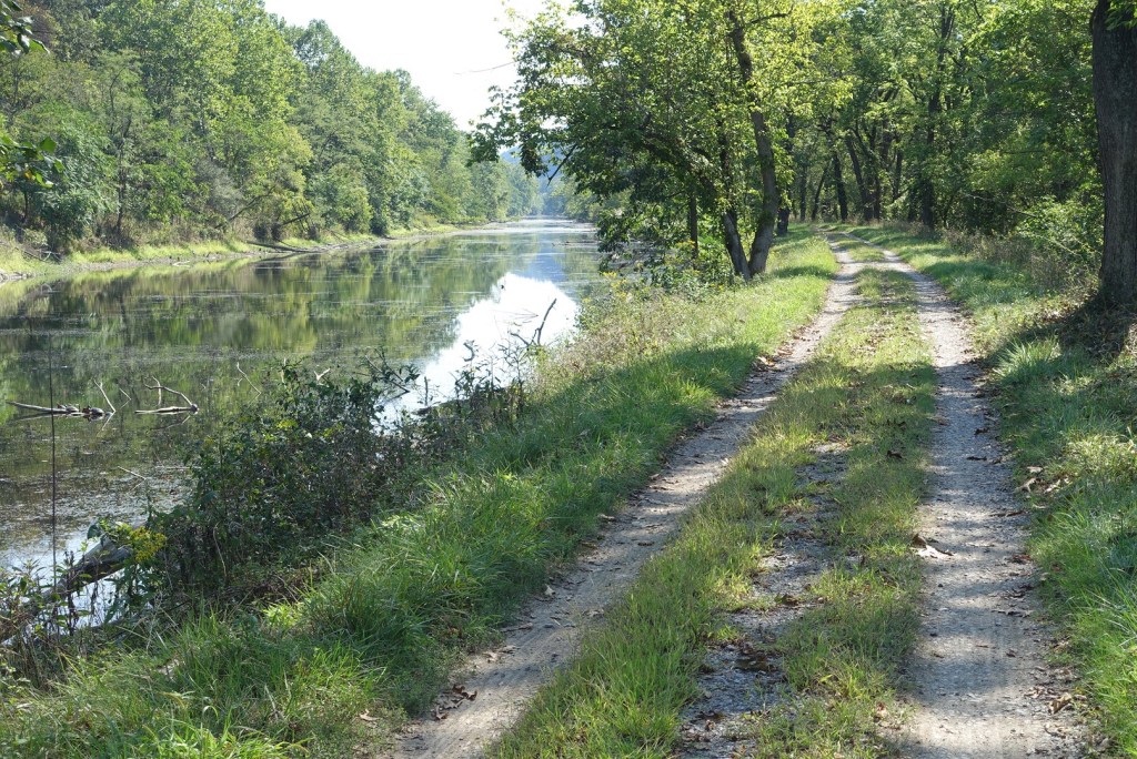
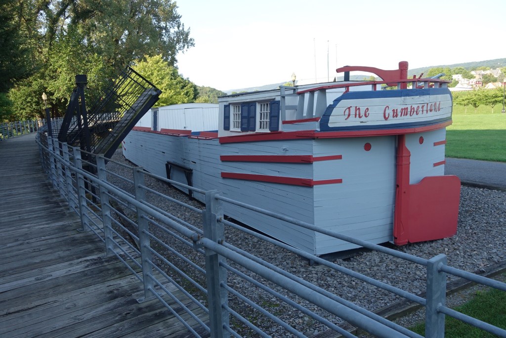
As I go, I sense that I am riding alongside history. The canal was an efficient route of transportation back in the early 19th century, before the railroad era. It was built beside the Potomac River, which would supply it with a constant flow of water. Goods were loaded on canal boats and pulled along by mules. “Packet” boats carried passengers. They moved about 3 mph. They could travel around the clock, but most tied up at night, so the trip from Washington to Cumberland was typically about four days, about the time I’m going to be taking. Unfortunately for the canal, the railroad came into existence and overtook it by the time the canal was finished. In other words, it was obsolete by the time it was completed in 1858.
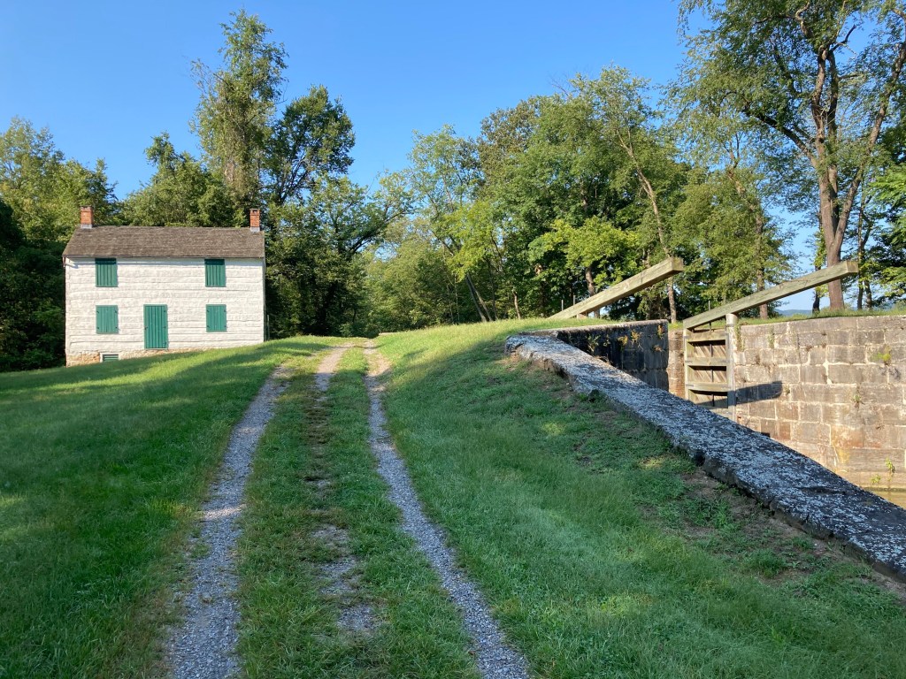
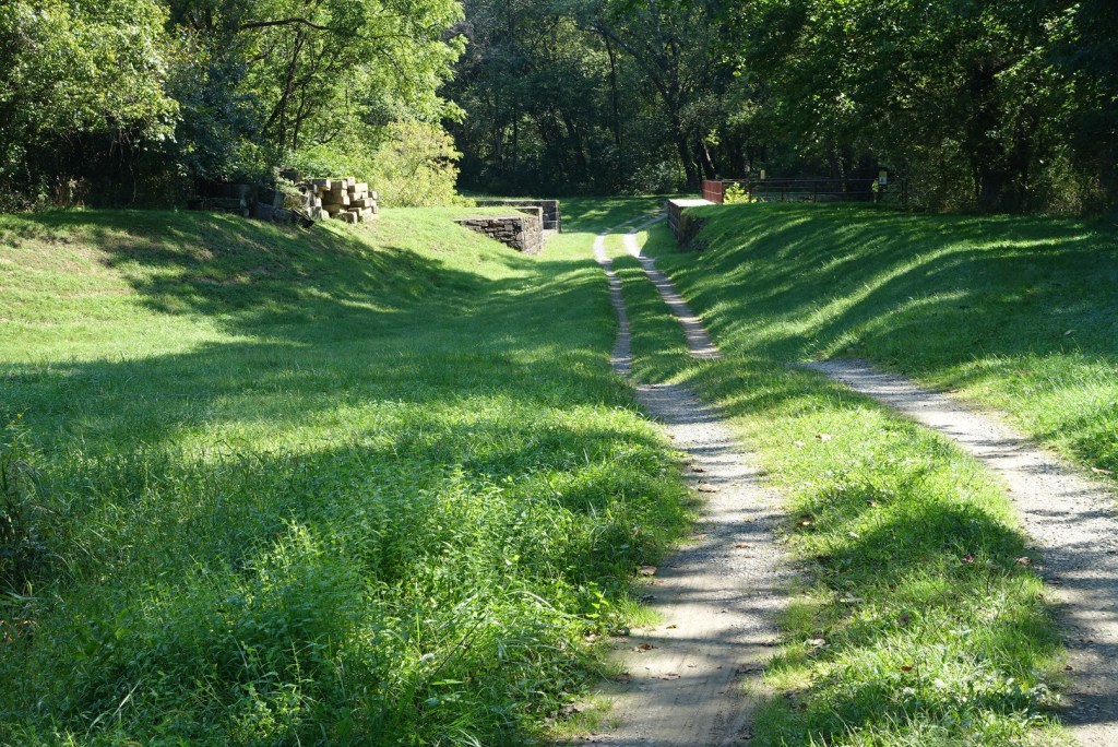
Even though the canal has been out of use for a long time, traces of the old locks (there were 74) and the lock keepers’ homes are still there, and some very well preserved.
There are few if any places to stay along here, unless you are camping. There are primitive campsites about every 5 miles, which makes that a very good option. These are also nice places to stop and have your lunch or take a rest. And they have outhouses.
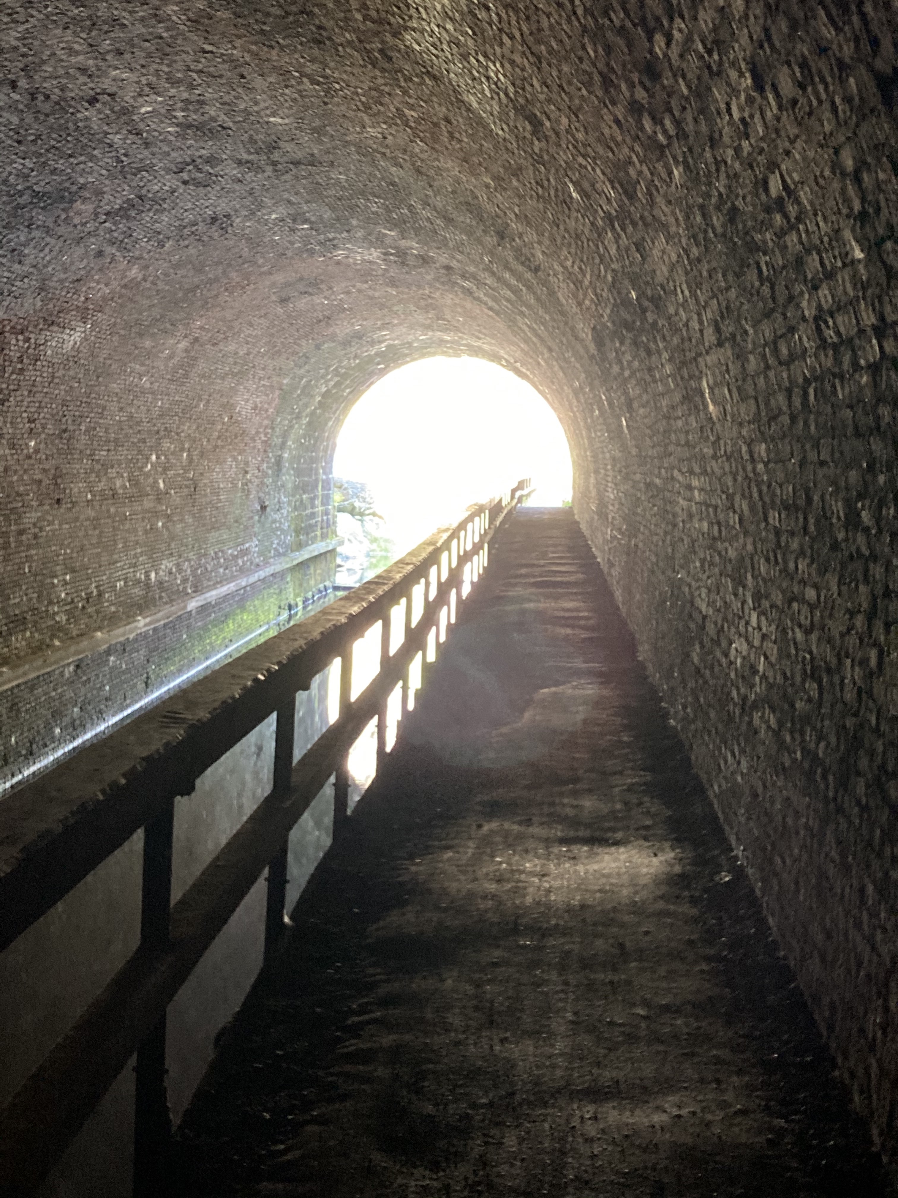
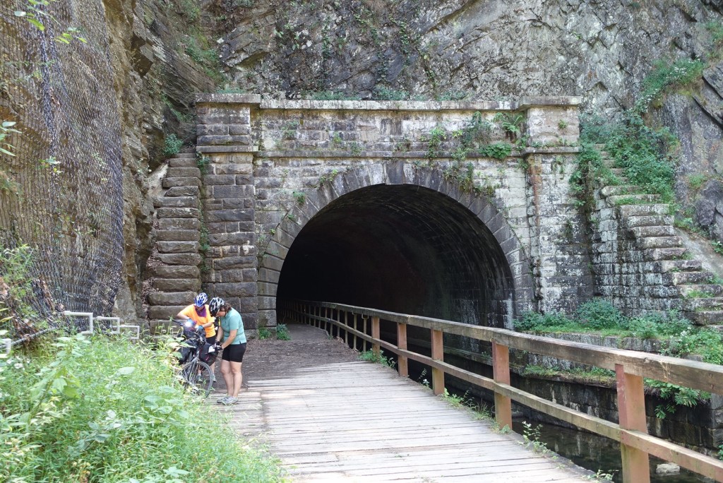
Probably the most interesting feature of today’s ride was the the Paw Paw tunnel. It’s over 3,000 feet long and took 12 years to build, with immigrant labor, starting in 1835. The original idea was to save 5 miles of canal by creating the tunnel. But there was a great deal of labor unrest and cost overruns which made the whole thing questionable by the time it was finished. The tunnel itself is lined with over 6 million bricks. There are no lights inside and you need to walk your bike, with a headlight.
I had my picture taken by a couple of women who were riding behind me much of the day. They offered to take my picture, and at that point I realized that the two of them were deaf. I regretted that I don’t know how to say “thank you” in sign language.

The entire C&O canal is a national park. Much of the section that I rode today feels very remote and since we are cutting through the eastern edge of the Allegheny Mountains there very few towns anywhere along the way. About halfway through today’s ride was Oldtown, where the old school has been converted into a kitchen/ rest stop for cyclists. Rita, the person who runs the place says she is the “head cook, chief bottle washer and CEO.” She happily filled my water bottles and washed them off for me.
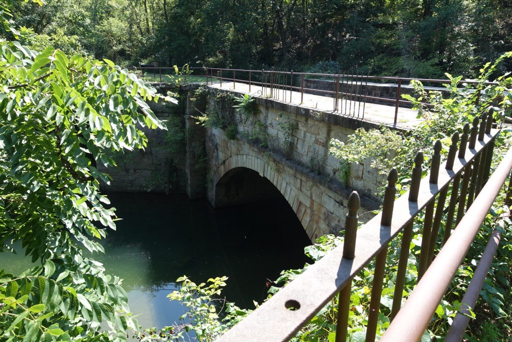
I finished my day in the town of Little Orleans. It’s basically just a store, and that store was closed today. But just before I got there I passed over an aqueduct at Fifteenmile creek. This is another one of the very unusual phenomena along the canal. They are actually built above the larger waterways, kind of like a bridge of water over water. Some of them have been abandoned and a path goes through the aqueduct now, but several are still in existence though they don’t have any water in them. They’re quite a sight to see.
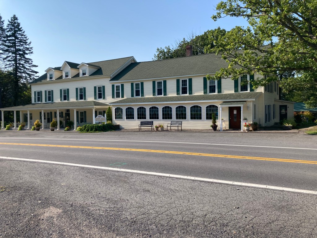
I chose to spend the night at a B&B about 7 miles off the canal. They tell me that they have about 700 cyclists in a typical year, though this is not a typical year. Since it’s up on top of a ridge, about 1600 feet above sea level, I elected to get a shuttle ride up there.
Tomorrow I continue my journey to the town of Williamsport, about 40 miles away.

Another great and interesting post – intertwining the history of each area! I have some familiarity with the Little Orleans and Paw Paw Tunnel. They are near a Maryland Army National Guard Training Site, call Camp Baker Training Site. It is adjacent but above the Potomac River. It is used for adventure training – rappelling, day/night land navigation, escape/evasion training for Army pilots, and other related wilderness survival skills training. I spent many days and nights there during my Army National Guard career. When looking down at the Potomac I remember seeing a tunnel – Paw Paw? It is a beautiful facility, once owned by the Boy Scouts. Thanks again for your these great posts. This will make a terrific new book!
LikeLike
Here is a link of an aerial of Baker Training Site – https://military.maryland.gov/Pages/facilities.aspx
LikeLike