Walking the Way of St. Francis is a challenging and deeply rewarding pilgrimage. Florence to Rome, it covers 350 miles (over 550 kilometers) of beautiful vistas, charming villages and hilltop towns as well as rugged forests and mountains.
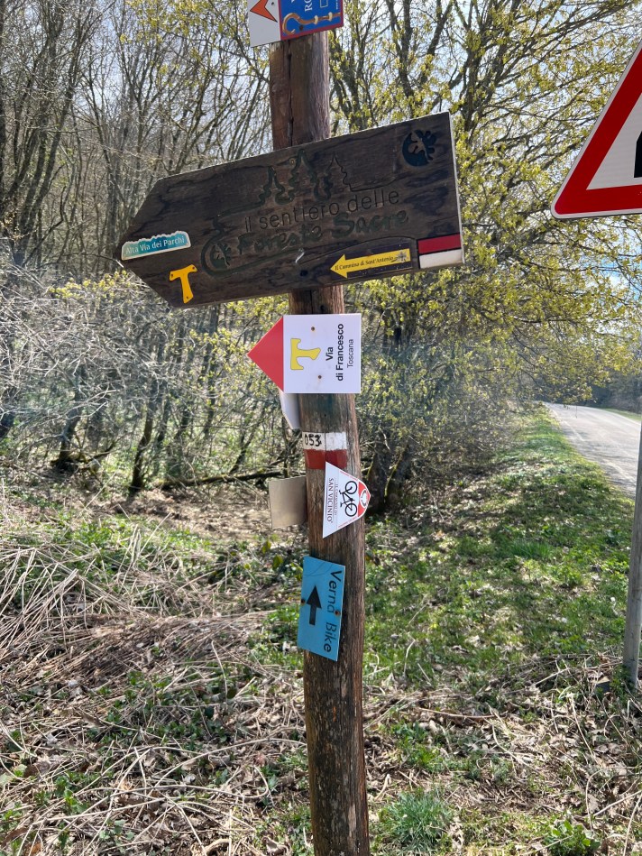
However, navigating it can be tricky; the route is actually a consortium of up to eight different routes, some with their own signs and markers, not to mention the trails of the Club Alpino Italiano (CAI or Italian Hiking Club) which actually form the heart of the entire route.
Different regions are signed better, such as Umbria, but relying on markers alone, or even using a good guidebook, might be a bit risky.
The best way to go is to use a mobile phone with GPX tracks on it. GPX (GPS Exchange Format) is simply a trail that is recorded and marked on a digital map. I have used them a great deal in recent years, both in hiking and biking (including the entire 1,000 mile-long Land’s End to John ‘O Groats route in the UK). All the GPX that files I’ve used over the years are made available for free, and they function with a mobile app, such as Guru Maps or Gaia, both of which have paid and free versions. I also use them at home on my hikes.

I have had both for so long that I’m not sure how much the paid versions cost, but it is likely to not be more than about $5 and they allow for the option to download maps for offline use. Whichever app or whichever version you use, it is advisable to have topographical maps visible on your settings.


Getting up and running with GPX tracks is easy, once you have downloaded either GURU or GAIA. You can download the GPX tracks at the Way of St. Francis Facebook group at this link. Make sure you download both sets of tracks, Florence to Assisi and Assisi to Rome.
GAIA and GURU actually allow you to download them directly into the app; it’s that simple. You will now have the routes on your mobile device and they stay there.
You can even use GURU if you don’t have a data plan, since your phone always uses GPS to know your location. Both apps also will not only show where you are, but even the direction you are walking, a handy feature. I do recommend downloading the maps of the region to your phone for offline use, in the event that you lose (or choose not to have) a data plan on your phone.
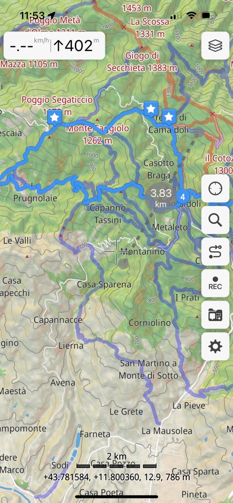
Another very handy feature of both apps is that alternative trails are available on your interface. We used it to take some shortcuts when we walked the Way of St. Francis. The bright blue is our route, but the purple trails are recorded tracks that mark other trails and are available when you download the map to your phone.
Russ Eanes is a writer/walker/cyclist from Harrisonburg, VA and the author of Pilgrim Paths to Assisi: 300 Miles on the Way of St. Francis and The Walk of a Lifetime: 500 Miles on the Camino de Santiago.

You must be logged in to post a comment.